North Texas Hill Country residents organize to preserve FM 4
Ann Powers
Editor
SANTO – The Texas Department of Transportation delivered a scaled-down version of its controversial feasibility study to redirect Farm-to-Market 4 around the future Turkey Peak Reservoir at a public meeting in Santo, Aug. 20.
While residents say the updates are better, they’re still concerned TxDOT’s plans will tarnish the roadway’s picturesque scenery, erase its historic significance, and negatively impact ranches, businesses and homes.
“We’re a lot happier,” Caitlin Bowden said of the revised study. “But we’re still going to fight to preserve FM 4.”
Bowden launched a website called Save FM 4 to bring awareness to TxDOT’s proposal which alters one of the state’s oldest and longest roadways. Bowden, her dad Casey McGlaun, and the rest of her family are forming a coalition to bring people together to offer options and solutions.
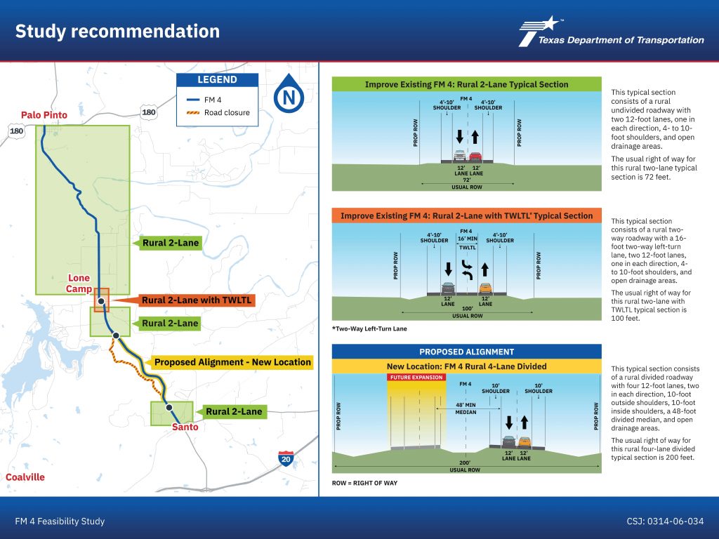
The state’s goal is to reroute a 14-mile stretch of FM 4 around the future Turkey Peak Reservoir immediately south of Lake Palo Pinto when it’s finished, said TxDOT Public Information Officer Bethany Kurtz.
Because a portion of FM 4 will be underwater when the new lake is completed, the updated study includes adding a new section of county road to account for parts of the road left submerged.
FM 4 is currently a rural undivided roadway with two 10-foot lanes, 2-foot shoulders, and a 70-foot right of way, according to the feasibility study.
The state’s original proposal was presented at a meeting last April in Santo. The plan included four different route options.
Two of them bypassed Santo and Palo Pinto and all of them had a 70 mph speed limit. The highway varied from two lanes to four lanes at various sections along the study’s corridor.
Long-term plans called for a 6-lane, 70 mph route with 12-foot lanes and a 200-foot right of way, which McGlaun called a “super highway.”
The study had locals fearing a long list of losses including land, homes, businesses, an iconic roadway, and a tranquil way of life in North Texas Hill Country.
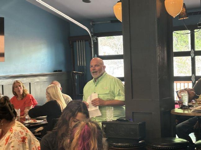
McGlaun organized his own public meeting at the Lone Camp Community Center on Aug. 15. More than 130 anxious community members crowded the facility, hungry for information, brimming with questions and lining up to fill out comment cards for the state.
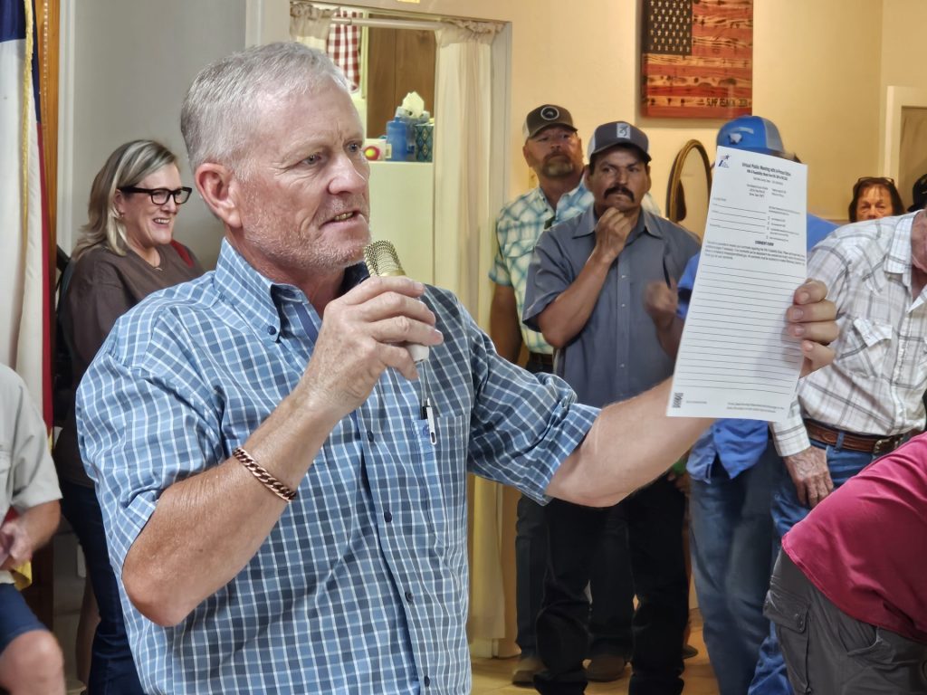
McGlaun, an area homebuilder, said the original proposal would have cut through his 56-acre property.
“In essence creating another U.S. Highway 281,” McGlaun said. “TxDOT will be taking my home, my cabinet shop, my sawmill, my home building office, my exotic Hoofstock breeding facility, along with 10-to-12 acres of my land, as well as at least two of my neighbors’ homes.”
McGlaun and his wife, Liz, also intend to build their “dream home” on the land, located about six miles north of Santo. He said community members shared similar concerns, which were submitted to the state.
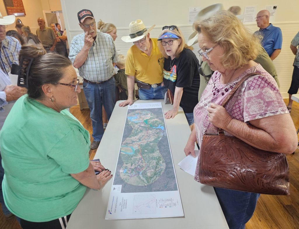
Based on feedback from April’s study, TxDOT presented a whittled-down proposal during a public meeting at the Santo Baptist Church, Aug. 20. The come-and-go format allowed a packed room of attendees to view an informational video, maps and exhibit boards.
TxDOT officials were also on hand to answer questions.
The updated version eliminates the routes bypassing Santo and Palo Pinto and proposes one 55 mph highway, with 12-foot lanes, 4-to-10-foot shoulders and right of ways ranging from 72-to-200 feet.
“We reduced the speed limit to allow the route to have more scenic curves,” Kurtz said.
The routes bypassing Santo and Palo Pinto were removed due to concerns about businesses losing customer traffic through the area and the additional property the state would need to acquire, Kurtz added.
The north-south highway will vary from two lanes to four at various sections along the corridor, according to the study.
The six-lane option is also gone from the plan. But, Kurtz said it’s always a possibility for roads experiencing a major traffic increase.
“It’s on the table for any roadway that suddenly becomes large and booms and needs that kind of space,” Kurtz explained. “But we don’t think that’s warranted for the duration of this study.”
Additionally, the new plan will not take out any homes or other structures.
“While right of way will be needed… it’s not going to go through any homes or structures for displacement,” Kurtz said.
McGlaun said the revised route still cuts through a portion of his land and he’ll have to move his breeding pen facility. However, he’s more concerned about his neighbors who will be greatly impacted by the new plan.
“We didn’t start this fight just for ourselves,” McGlaun said. “They are still taking out a big cut to the middle of one of my neighbor’s ranches.”
Residents also wanted to know why the state is conducting the study when the Turkey Peak Reservoir project already has designs, with the same goal in mind, that are approved and funded.
Palo Pinto County Municipal Water District No. 1 owns Lake Palo Pinto, the area’s main water source struggling to meet current needs. The new reservoir is estimated to increase water storage capacity by 83% for the district’s 34,979 customers in Palo Pinto and Parker counties.
The district recently received a $200 million state loan last month to start construction on the new reservoir. The 30-year, low-interest loan will be paid back with revenue bonds backed by a 146% water rate increase approved by the Mineral Wells City Council last year.
The reservoir’s construction phase includes a new earthen dam, partial removal of the lake’s spillway, and a new county road and bridge across its dam.
A three-quarter mile section of new county road will be installed from Brown Road to North Lakeview so people can travel to the west side of the lake when portions of FM 4 are submerged under Turkey Peak Reservoir.
Part of Ward Mountain Road, which loops off east of FM 4 and reconnects near Palo Pinto Creek, will also be upgraded.
“They’ve got a complete plan over there once this Turkey Peak goes through,” said James Cobb, a Palo Pinto County resident and automotive shop owner. “It’s already paid for, it’s already funded, it’s already thought out.”
Cobb, and others, questioned whether the two entities were communicating to each other about their FM 4 revisions.
Water district manager Howard Huffman said TxDOT is well aware of the district’s plans, but decided to propose its own.
“The district does not tell TxDOT what to do,” Huffman said. “They have known about this for a long time. We’re going to do what we have to do to make things better when we put the reservoir in.”
Kurtz said TxDOT has had conversations with the water district, but the state has a different set of design standards.
Feasibility studies do not determine costs and funding, Kurtz added. Those discussions occur during the project development phase if the state accepts the study’s recommendations.
McGlaun is not a fan of the water district’s plan, but said the state’s proposal is worse. He said TxDOT’s changes will result in more people losing land than the district’s plan.
McGlaun added that FM 4 doesn’t have a continuous 2-foot shoulder as stated in TxDOT’s study. His answer to the overall problem is to make the necessary improvements to reconnect the submerged portion of the roadway and add two-foot shoulders to the rest of the highway.
“It’s not even a full two lanes and the asphalt has chunked back,” McGlaun said. “Every single person here will tell you all they want is a 2-foot shoulder on FM 4. That’s as safe as it needs to be and it will be the same scenic highway.”
Bowden and her two sisters grew up traveling the winding route to and from school. Now she works and lives in Aledo.
“I find any and every excuse to get out to the Santo, Lone Camp area and drive Highway 4 just to get away from the craziness,” Bowden said. “It’s my stomping grounds. It’s where I grew up.”
Like her dad, she isn’t impressed with the state’s revamped study.
“They may not be wiping out structures, but this road is still going to be right in front of people’s homes – this road that they don’t want,” Bowden said. “If they’re going to do this now, what are they going to do in ten years?”
Save FM 4 can be viewed at www.savefm4.com. The website offers additional information, comment cards and ways to get involved and donate.
For more information on the Turkey Peak Reservoir Project, visit www.turkeypeakreservoir.com.
The latest version of TxDOT’s FM 4 feasibility study and comment cards are posted on the agency’s website until Sept. 4. Go to www.txdot.gov and type “FM 4 from US 180 to FM 2201” in the search bar.
Comments can be emailed to fm4palopinto@txdot.gov and are due by Sept. 4.
Mailed comments must also be received by Sept. 4 at TxDOT Fort Worth District, attention Nazrul Chowdhury, 2501 SW Loop 820, Fort Worth, Texas 76133.
Kurtz said the study team will review public feedback for incorporation into the final report and recommendations to the state this fall.